
_gro%C3%9F2.jpg&w=3840&q=75)
Surveying & Documentation
High-precision digital as-built documentation, 3D scans, and drone surveying for your line routes and facilities.
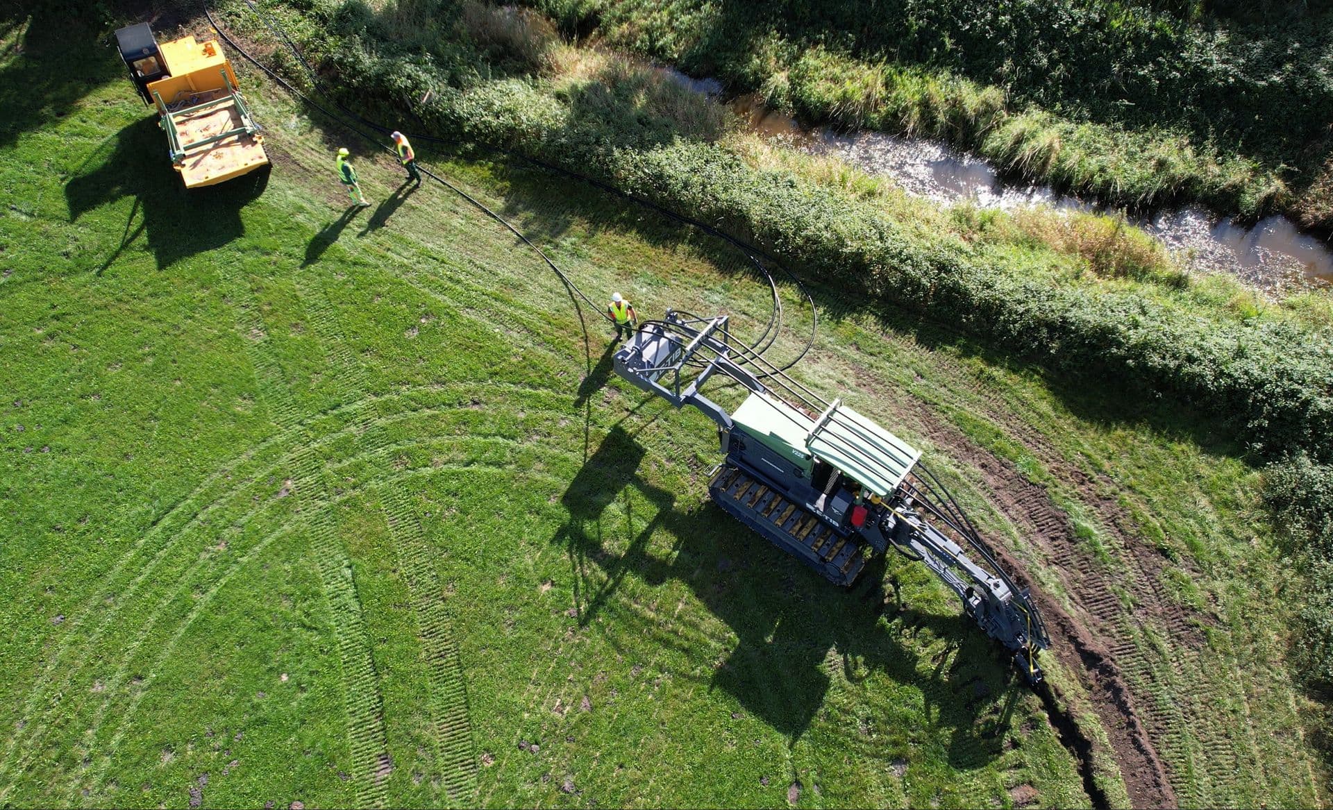
Leveraging ultra-precise, state-of-the-art GNSS/GPS technology and proprietary app integrations, we automate the surveying process to deliver seamless, real-time documentation.
Centimeter Precision Prevents Costly Operations
Regulatory documentation mandates and safety benchmarks are expanding rapidly. Traditional civil engineering contractors frequently struggle to meet these highly complex data requirements—especially under strict public funding frameworks. Neglecting or incorrectly mapping underground routes inevitably triggers major roadblocks during project handovers, audit reviews, and long-term asset management.
Recognizing this critical bottleneck early, we pro-actively integrated advanced geodetic surveying and digital mapping directly into our core operations.
Cutting-Edge Digital Twin & GIS Records
Using advanced GNSS/GPS devices and in-house developed digital workflows, we capture the precise physical reality of every conduit and utility in real-time. This automated process generates a highly accurate digital twin of your underground infrastructure.
Beyond classic surveying, staking, and as-built mapping, we construct fully integrated geodatabases for transparent project accounting. We also provide complete, immersive 360° photo and video documentation of the construction area before and after ground-breaking. This ensures you maintain full transparency, legal compliance, and total control over your physical assets.
Precision
Digital Safety Standards
We do not only deliver a clean route, but also the perfect data. Legally compliant, digital and precise to the centimeter.
Classic Geodesy
- Staking out of line routes with centimeter precision
- Surveying of existing routes and new lines
- Highly precise GPS-supported terrain recording
- Automated app-based measuring procedures
Digital Documentation
- Creation of databases for project accounting
- 360° photo and video recording of the construction field
- Integration and processing for Geographic Information Systems (GIS)
- Audit-proof inventory plans
Case Studies
Documented Projects


Need support?
Our team of experts is available to answer all your questions regarding your infrastructure project.
Contact Us→